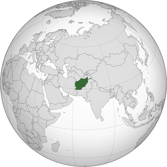
𐍆𐌴𐌹𐌻𐌰:Afghanistan (orthographic projection).svg

Size of this PNG preview of this SVG file: 553 × 553 𐍆𐍂𐌹𐍃𐌰𐌷𐍄𐌹𐍃𐍄𐌰𐌱𐌴𐌹𐍃. Other resolutions: 240 × 240 𐍆𐍂𐌹𐍃𐌰𐌷𐍄𐌹𐍃𐍄𐌰𐌱𐌴𐌹𐍃 | 480 × 480 𐍆𐍂𐌹𐍃𐌰𐌷𐍄𐌹𐍃𐍄𐌰𐌱𐌴𐌹𐍃 | 768 × 768 𐍆𐍂𐌹𐍃𐌰𐌷𐍄𐌹𐍃𐍄𐌰𐌱𐌴𐌹𐍃 | 1,024 × 1,024 𐍆𐍂𐌹𐍃𐌰𐌷𐍄𐌹𐍃𐍄𐌰𐌱𐌴𐌹𐍃 | 2,048 × 2,048 𐍆𐍂𐌹𐍃𐌰𐌷𐍄𐌹𐍃𐍄𐌰𐌱𐌴𐌹𐍃.
𐍆𐍂𐌿𐌼𐌹𐍃𐍄 𐍆𐌰𐌾𐌻 (SVG file, nominally 553 × 553 pixels, file size: 298 KB)
𐍆𐌰𐌾𐌻𐌰𐍃𐍀𐌹𐌻𐌻
𐌰𐍄𐍄𐌴𐌺 𐌳𐌰𐌲/𐌼𐌴𐌻 𐌳𐌿 𐌱𐌰𐌽𐌳𐍅𐌾𐌰𐌽 𐍆𐌰𐌾𐌻 𐍃𐍅𐌰𐍃𐍅𐌴 𐌲𐌰𐌱𐌰𐌹𐍂𐌷𐍄𐌹𐌳𐌰 𐌹𐌽 𐌸𐌰𐌼𐌼𐌰 𐌼𐌴𐌻𐌰.
| 𐌼𐌴𐌻 | 𐌻𐌴𐌹𐍄𐌹𐌻𐌰 𐍆𐍂𐌹𐍃𐌰𐌷𐍄𐍃 | 𐍅𐌰𐌷𐍃𐍄𐌿𐍃 | 𐌱𐍂𐌿𐌺𐌾𐌰𐌽𐌳𐍃/𐌱𐍂𐌿𐌺𐌾𐌰𐌽𐌳𐌹 | 𐍅𐌰𐌿𐍂𐌳 | |
|---|---|---|---|---|---|
| 𐌽𐌿 | 14:46, 27 𐌷𐌰𐍅𐌹𐌼𐌴𐌽𐍉𐌸𐍃 2019 |  | 553 × 553 (298 KB) | Cerebellum | Revert to prior version, please provide a source for those territorial claims |
| 10:29, 26 𐌷𐌰𐍅𐌹𐌼𐌴𐌽𐍉𐌸𐍃 2019 |  | 720 × 720 (384 KB) | Lakshmisreekanth | Updated color | |
| 17:00, 25 𐌷𐌰𐍅𐌹𐌼𐌴𐌽𐍉𐌸𐍃 2019 |  | 720 × 727 (397 KB) | Lakshmisreekanth | Added claimed regions | |
| 23:36, 16 𐌼𐌰𐍂𐍄𐌾𐌿𐍃 2015 |  | 553 × 553 (298 KB) | Flappiefh | Removed Somaliland and Kosovo. Separated Western Sahara and Morroco. | |
| 12:43, 4 𐌰𐌲𐌿𐍃𐍄𐌿𐍃 2013 |  | 553 × 553 (302 KB) | Flappiefh | Added South Sudan. The map is now centered on Afghanistan. | |
| 22:45, 20 𐍆𐍂𐌿𐌼𐌰 𐌾𐌹𐌿𐌻𐌴𐌹𐍃 2009 |  | 541 × 541 (506 KB) | File Upload Bot (Magnus Manske) | {{BotMoveToCommons|en.wikipedia|year={{subst:CURRENTYEAR}}|month={{subst:CURRENTMONTHNAME}}|day={{subst:CURRENTDAY}}}} {{Information |Description={{en|Afghanistan orthographic_projection}} |Source=Transferred from [http://en.wikipedia.org en.wikipedia]; |
𐍆𐌰𐌾𐌻𐌰𐌱𐍂𐌿𐌺𐌴𐌹𐌽𐍃
There are no pages that use this file.
𐌱𐍂𐌿𐌺𐌴𐌹𐌽𐍃 𐍆𐌰𐌾𐌻𐌴 𐌰𐌻𐌻𐌰𐌹𐌼 𐍃𐍄𐌰𐌳𐌹𐌼
𐌸𐍉 𐌹𐍆𐍄𐌿𐌼𐍉𐌽𐌰 𐌰𐌽𐌸𐌰𐍂𐌰 𐍅𐌹𐌺𐌾𐌰 𐌱𐍂𐌿𐌺𐌾𐌰𐌽𐌳 𐌸𐌹𐍃 𐍆𐌰𐌾𐌻𐌹𐍃:
- 𐌱𐍂𐌿𐌺𐌴𐌹𐌽𐍃 𐌰𐌽𐌰 ady.wikipedia.org
- 𐌱𐍂𐌿𐌺𐌴𐌹𐌽𐍃 𐌰𐌽𐌰 af.wikipedia.org
- 𐌱𐍂𐌿𐌺𐌴𐌹𐌽𐍃 𐌰𐌽𐌰 ami.wikipedia.org
- 𐌱𐍂𐌿𐌺𐌴𐌹𐌽𐍃 𐌰𐌽𐌰 arc.wikipedia.org
- 𐌱𐍂𐌿𐌺𐌴𐌹𐌽𐍃 𐌰𐌽𐌰 ar.wikipedia.org
- 𐌱𐍂𐌿𐌺𐌴𐌹𐌽𐍃 𐌰𐌽𐌰 arz.wikipedia.org
- 𐌱𐍂𐌿𐌺𐌴𐌹𐌽𐍃 𐌰𐌽𐌰 ast.wikipedia.org
- 𐌱𐍂𐌿𐌺𐌴𐌹𐌽𐍃 𐌰𐌽𐌰 as.wikipedia.org
- 𐌱𐍂𐌿𐌺𐌴𐌹𐌽𐍃 𐌰𐌽𐌰 av.wikipedia.org
- 𐌱𐍂𐌿𐌺𐌴𐌹𐌽𐍃 𐌰𐌽𐌰 awa.wikipedia.org
- 𐌱𐍂𐌿𐌺𐌴𐌹𐌽𐍃 𐌰𐌽𐌰 azb.wikipedia.org
- 𐌱𐍂𐌿𐌺𐌴𐌹𐌽𐍃 𐌰𐌽𐌰 az.wikipedia.org
- 𐌱𐍂𐌿𐌺𐌴𐌹𐌽𐍃 𐌰𐌽𐌰 az.wiktionary.org
- 𐌱𐍂𐌿𐌺𐌴𐌹𐌽𐍃 𐌰𐌽𐌰 ba.wikipedia.org
- 𐌱𐍂𐌿𐌺𐌴𐌹𐌽𐍃 𐌰𐌽𐌰 bbc.wikipedia.org
- 𐌱𐍂𐌿𐌺𐌴𐌹𐌽𐍃 𐌰𐌽𐌰 be-tarask.wikipedia.org
- 𐌱𐍂𐌿𐌺𐌴𐌹𐌽𐍃 𐌰𐌽𐌰 be.wikipedia.org
- 𐌱𐍂𐌿𐌺𐌴𐌹𐌽𐍃 𐌰𐌽𐌰 bew.wikipedia.org
- 𐌱𐍂𐌿𐌺𐌴𐌹𐌽𐍃 𐌰𐌽𐌰 bg.wikipedia.org
- 𐌱𐍂𐌿𐌺𐌴𐌹𐌽𐍃 𐌰𐌽𐌰 bh.wikipedia.org
- 𐌱𐍂𐌿𐌺𐌴𐌹𐌽𐍃 𐌰𐌽𐌰 bi.wikipedia.org
- 𐌱𐍂𐌿𐌺𐌴𐌹𐌽𐍃 𐌰𐌽𐌰 bn.wikipedia.org
- 𐌱𐍂𐌿𐌺𐌴𐌹𐌽𐍃 𐌰𐌽𐌰 bn.wikivoyage.org
View more global usage of this file.
